Why?
At Shift I try to advocate for using generic software in the Construction industry for a number of reasons. Often they are more mature than their Construction counterparts, so an issue tracking tool like JIRA will have much more opportunity for intergations and customisation than a more Construction focussed tool. The other benefit is that they often have free trials, or in the case of Google Maps, are completely free.
Challenge
The pain point I am targeting today is around logistics, and the communication of logistics plans. On most projects I have worked on the logistics plan has been represented in a fairly static fashion, usually a PDF, powerpoint or image that gets uploaded to a CDE or emailed around, much like the one below.
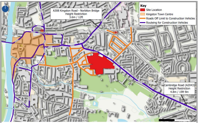
There are several challenges with these kinds of documents:
- They are not live. Logistics strategies evolve over time by their very nature, the laydown areas, access gates or crane positions will change as the construction sequence evolves. How do you know if the image you are looking it is the latest version?
- They are time consuming. Often these markups are produced on top of images of maps, so all of the intelligence has been lost. I can’t insert a route based on a start and end point, I need to draw it on with a line tool.
- They’re hard to share. If I put my image on a CDE I have to make sure everyone who needs access has been granted it by the system administrators. If I email it I have no way of controlling who I’ve sent it to so I can send updates.
- They don’t meet the user where they are. In my day to day life I can’t remember the last time I did any kind of wayfairing based on an image based map. If someone asks me to attend a meeting in a new place, I don’t ask them to draw a map, I ask them for their postcode and I type it in my phone. Relying on everyone that visits the site to mentally translate what they see in an image onto their phone or satnav feels like a bit of a waste.
Solution
Now time to talk you through how I advocate addressing these problems. This solution is not going to be for everyone, but I hope that this short tutorial will shed some light on what’s possible with more generic tools.
First things first is to visit My Maps (google.com) and sign in to your Google account. If you don’t have a Google account you can create one using any email address (you don’t need to sign up for Gmail). Once you’re in click on the “CREATE A NEW MAP” button in the top left and you’ll be taken to a rather zoomed out map:
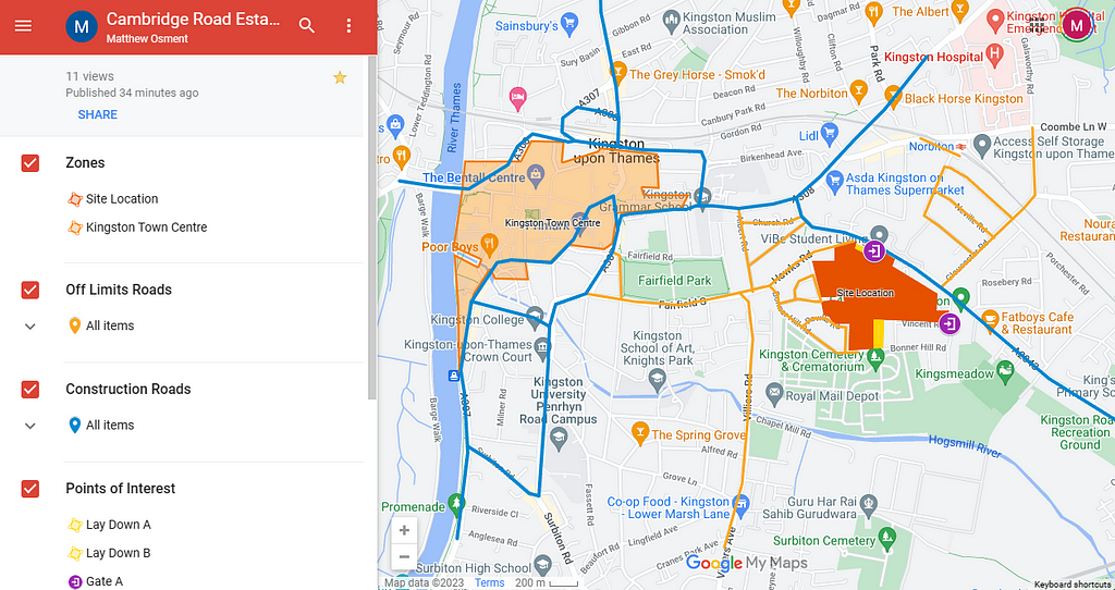
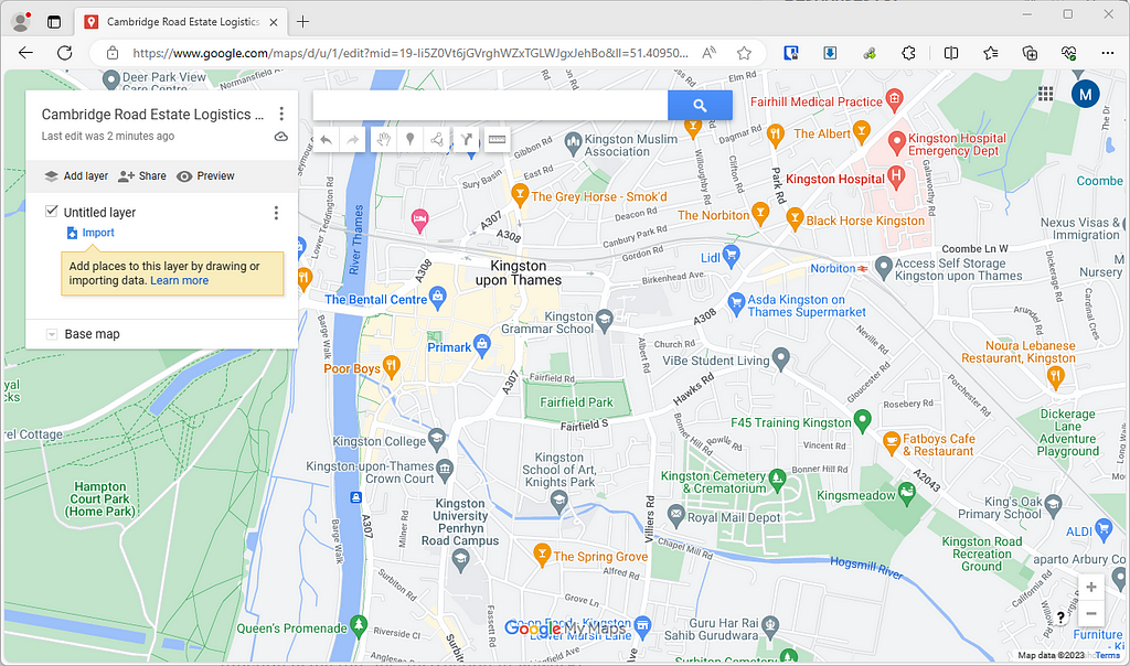
Now you’ll want to give your map a name, for the sake of this demo I’m going to duplicate the map in the image at the beginning of the article, so I’ll call it “Cambridge Road Estate Logistics Plan” and zoom in to the area I want to cover:
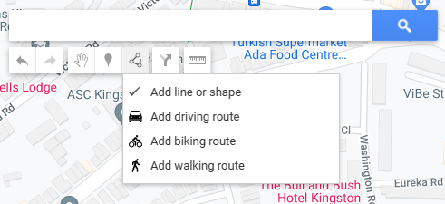
On the left hand side you can see the Layers, it is up to you how you want to handle these, but for the sake of this project I will keep all of the zones on one layer and the routes on two seperate layers. So we’ll rename the “Untitled Layer” to be “Zones” and draw out the 2 zones from out original drawing by going to the “Add line or shape” tool in the top tool bar:
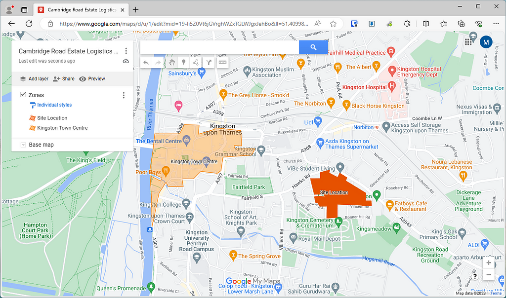
You can see in the image above I’ve played around with the transparency a little and under the “Individual Styles” link on under Zones I was able to add labels directly onto the map, which scale as I zoom in and out.
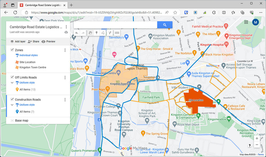
Then I’ll add the routes in using the Line tool, each line creates a new record in the layer so rather than having multiple random lines I will set that layer to have a “Uniform Style”, and then I can adjust the colour and line thickness of the entire layer at once:
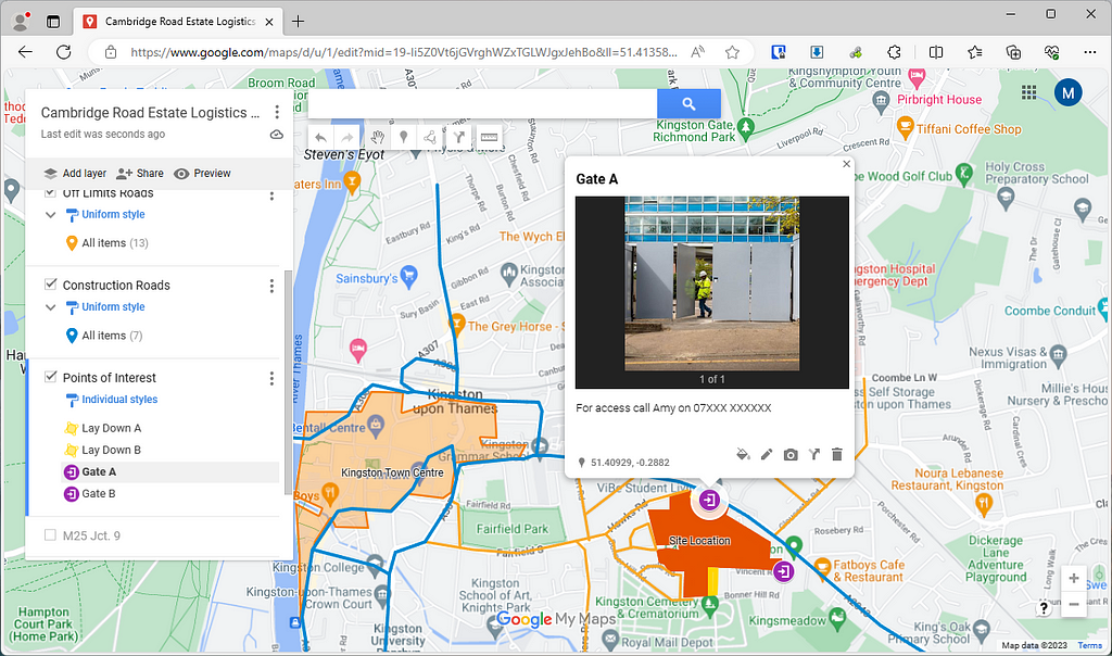
Now we could stop there and just share the map, but I also want to take advantage of the platform we’re using, so I’m going to add it a few routes from various exits of the M25 to help haulers who might not be familiar with the area. I will also add some gates and access Lay Down areas to the map, along with images and the phone number of the security guard to help anyone stuck at the gate:
Now we’re done and ready to share, I can hide and show any shapes, pins or routes and set a default view, then click the “Share” button in the card on the left. For the sake of this demo I’m going to share the map publicly so that I can embed it here and anyone reading this can see how easy it is to interact with:
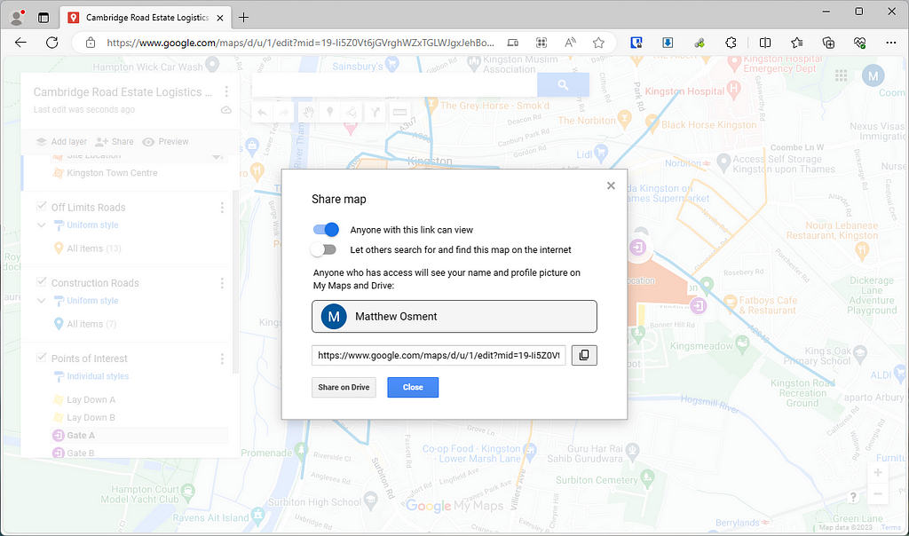
Now I can embed the map inside any page, like Sharepoint, this blog post or Microsoft Teams. Anyone with access to the link (Cambridge Road Estate Logistics Plan) can access the map, filter it or get directions to a particular waypoint in Google Maps. The best thing about this link is that it’s live, so any changes I make to the map will be reflected in the live map and I don’t have to update any documents on the CDE or email everyone the update. The end user can also export the map to look at in Google Earth or any other mapping tool they want, they can even add it to their own map library.
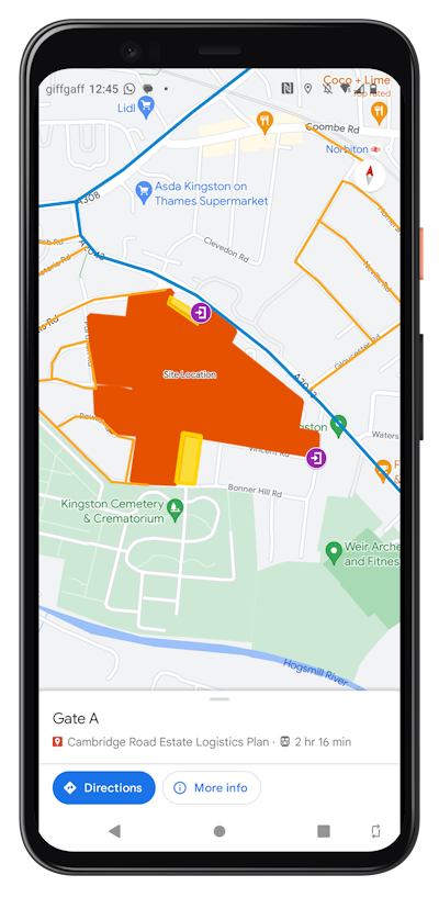
Now for my favourite feature. Once I have added the map to my library on my google account, I can open Google Maps on my phone and turn the maps on inside my regular app, no additional software needed. Now the whenever I am near site and load up Google Maps on my phone I can see all of the additional points of interest on the map, perfect for finding meeting rooms, identifying tower cranes or hazard areas.
Alternatives
I have used Google Maps as the demo here as it is largely the most prevalent, but there are some other tools with varying levels of complexity/pricing:
- StoryMaps from ArcGIS is more of an experience than a map, you can create a narrative through the area, add custom maps tiles and more.
- Proxi has a lot more options and features collaboration tools so you can start to work together with your supply chain on top of your maps.
- Mapbox is the defacto standard for map creation, you can tweak every single aspect of a map, from colours to how points of interests are rendered at different zoom levels. It’s got some beginner friendly tooling, but I would say this is best for the enterprise level looking to rollout consistent mapping across all their projects.
Conclusion
So there you have it, a brief introduction to a simple and free workflow that might save you time on your next project (or your current one). Let me know in the comments if you have any other favourite mapping tools or if you can think of more use cases.
This article has been published as part of Shift, please follow us on Medium or LinkedIn for more.
Using Google Maps for Construction was originally published in Shift Construction on Medium, where people are continuing the conversation by highlighting and responding to this story.